
Cincinnati didn’t get called the City of Seven Hills because someone thought it sounded poetic on a postcard. The hills are the city’s underlying operating system. They decide where streets behave, where neighborhoods feel tucked away, where you get a view that stops you mid-sentence, and where infrastructure bills quietly explode.
And yes, the label is borrowed, Rome wore it first. Cincinnati leaned into it because the comparison fit (and because civic branding has always loved a good classical reference).
Seven hills, or “seven-ish”? Here’s the thing.
Hot take: people argue about the exact list because they’re treating the nickname like a topographic audit. It’s not. It’s a cultural shorthand for a city built on ridges and basins.
Still, most historical references cluster around recognizable high points and the neighborhoods that formed on or against them. If you want a practical way to think about the “seven,” use hills that did three jobs at once: they shaped early settlement, forced transportation solutions, and became neighborhood identity anchors. For more context, the history of Cincinnati Hills Ohio helps explain why the nickname has stuck even when the exact hill list gets debated.
Commonly cited hills/ridges include:
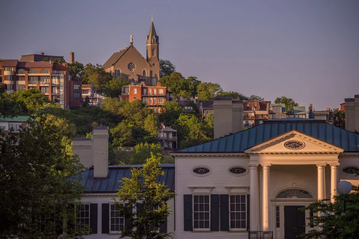
– Mount Adams (the show-off, views, parks, churches, and steep everything)
– Walnut Hills (big institutions, long corridors, layered housing stock)
– Mount Auburn (close to downtown, heavily shaped by grades and institutions)
– Clifton Heights / University Heights area (Uptown’s rise isn’t metaphorical)
– Fairview / Price Hill ridges (west side topography is the real deal)
– College Hill / Northside ridges (upland neighborhoods with their own gravity)
– Prospect Hill / the Over-the-Rhine edge (small but historically loud)
Now, this won’t apply to everyone, but in my experience the “seven” matters less than the pattern: Cincinnati is a set of elevated neighborhoods orbiting river commerce and basin industry.
One-line truth: If you ignore the grade, you misunderstand the city.
How the terrain quietly designed the street map
On flat land, you can pretend grids are destiny. On a hillside, the hill wins.
Cincinnati’s street network has these telltale signs of topography-driven planning: abrupt bends, short blocks that “stair-step,” switchbacks that feel like they were negotiated rather than engineered, and stairways that function like pedestrian streets. In technical terms, slope constraints limit right-of-way options, increase stormwater velocity, and narrow the margin for safe sightlines, so the geometry gets weird fast.
Look at the way neighborhoods “face” each other. Some slopes connect; others separate. A ridge can be a seam or a wall depending on how many crossings exist and whether they’re pleasant to use on foot (spoiler: often they aren’t).
And drainage? That’s not glamorous, but it’s the whole game. When you build on hills, water doesn’t politely disperse, it concentrates, accelerates, and finds the weak spot.
Immigrants didn’t just populate Cincinnati. They built it into the hills.
A lot of American industrial cities tell an immigration story, but Cincinnati’s version is physically legible. German and Irish communities, later joined by Italian, Polish, Appalachian migrants, and Black residents moving north during the Great Migration, formed tight neighborhood ecologies around work sites, churches, social halls, and streetcar access.
Over-the-Rhine is the headline example, but the pattern repeats: housing close to employment, then gradual climbing outward and upward as families stabilized, neighborhoods differentiated, and institutions followed.
Look, I’m not romanticizing it. Industrial growth also created brutal labor hierarchies, exclusionary housing practices, and environmental burdens that didn’t land evenly. Hills can protect you from floods, sure, but they can also isolate you from opportunity if connectivity isn’t built, and maintained.
Mount Adams, Over-the-Rhine, the terraces: a vertical city in miniature
If you want to feel the “Seven Hills” idea in your legs, go from the river basin up toward Mount Adams or the hills edging Over-the-Rhine and Mount Auburn.
What you’re experiencing isn’t just exercise. It’s an old urban logic:
– Riverfront = commerce and industry
– Lower slopes = dense housing and mixed use
– Upper elevations = institutions, parks, prestige housing (often), and strategic views
Terracing is the hidden architecture here. Retaining walls, stepped foundations, and split-level streets aren’t quirks; they’re solutions. They create that classic Cincinnati effect where the “front” of a house is on one street and the “back” feels like it belongs to another neighborhood entirely.
Architecture follows gravity (and sometimes fights it)
Cincinnati’s hillside building stock tells a consistent story: build compact where land is tight, anchor where bedrock and access allow it, and use the view as currency.
You’ll see:
Short sentence: Retaining walls are everywhere.
Rowhouses and tight Italianate streetscapes show up where lots are narrow and slopes demand efficiency. Larger homes and civic buildings perch where access roads and stable parcels made ambitious construction feasible. Even stylistic variety, Italianate, Second Empire, early modern, often sits on the same practical skeleton: stepped foundations, negotiated street frontage, and rooflines designed to look good from below.
And the parks? They’re not just pretty. They’re structural pauses in development patterns, places where steepness and public value aligned.
Transit had to get clever on hillsides
Steep grades don’t care about your preferred mode share. They set limits.
Historically, Cincinnati used streetcars and inclines to handle elevation changes and connect hilltops to employment basins. Those choices weren’t cute nostalgia. They were technology responding to geometry.
Modern planning still wrestles with the same constraints, bus routing on steep streets, winter traction, pedestrian stair maintenance, ADA accessibility, and the cost curve of rebuilding hillside infrastructure.
A specific number helps here: Cincinnati averages about 41 inches of snow per year depending on the dataset and period, which makes slope + freeze-thaw a real maintenance multiplier. Source: NOAA climate normals (Cincinnati/Northern Kentucky area).
Snow isn’t constant, but freeze-thaw cycles are relentless. Add hillside runoff and you get potholes, cracked steps, and slope stability headaches.
Culture and identity: yes, elevation changes how people relate
Some cities form identities around waterfronts. Cincinnati does that too, but the hills create smaller, sharper cultural edges. People don’t just say “I live in Cincinnati.” They say “I’m on the west side,” or “up in Clifton,” or “down by the basin,” and they mean it spatially, socially, and sometimes politically.
Neighborhood life becomes hyper-local when topography reduces casual cross-traffic. You end up with:
– corner business districts that serve as mini-downtowns
– park-overlook rituals (sunset watching is basically a civic hobby)
– stairway routes that locals treat like secret passages
And hillside microclimates are real. A ridge can be breezier and a few degrees different than the basin on a sticky summer night (you feel it immediately, even if you can’t quantify it on the spot).
Development on the hills: where romance meets geotechnical reality
Developers love views. Insurance companies love stability. Neighbors love not having a surprise landslide situation behind their house.
So hillside development becomes a constant negotiation: aesthetics, density, stormwater engineering, access, construction staging, and long-term maintenance. The hard costs escalate quickly when you’re doing serious grading, reinforcement, or drainage retrofits. Add historic street patterns and you’re juggling truck access, narrow rights-of-way, and community patience (limited, understandably).
Here’s the thing: the hills tempt reinvestment, and reinvestment can mean displacement if policy doesn’t keep up. If the city treats hillside neighborhoods as scenic assets but doesn’t build affordability, safe pedestrian links, and transit reliability, you get a familiar outcome, beautification for some, barriers for others.
What the Seven Hills still teach about “inclusive growth”
Inclusive growth on uneven terrain isn’t a slogan. It’s logistics and ethics at the same time.
If jobs, services, and safe routes cluster in the basin while upland neighborhoods lack reliable connections, elevation becomes a proxy for access. That’s not inevitable, but it’s common when infrastructure spending favors the easiest geometry and the loudest constituencies.
I’ve seen greenway and stairway investments do more for real mobility than flashy corridor projects, because they stitch together the short, steep gaps that actually define daily life.
A few ideas that tend to work (when funded and maintained, not just announced):
– Stairway restoration + lighting to make pedestrian routes safe and legitimate
– Stormwater-first street reconstruction on steep blocks (fix water, then pavement)
– Small green infrastructure, bioswales, tree canopy expansion, hillside plantings, to slow runoff
– Transit routing that respects topography, not just straight-line maps
Living with the hills (practical advice that isn’t corny)
If you’re visiting, plan your day like you’re in a city that has verticality, because you are. Pick routes that climb once and wander, rather than bouncing up and down all afternoon. Shoes matter more than you think.
If you live here, you already know the local wisdom: the fastest route on a map isn’t always the fastest in your body, your car, or your winter tires. And if you own hillside property, drainage and landscaping aren’t cosmetic chores, they’re stability work (annoying, yes; optional, no).
Cincinnati’s hills aren’t a trivia fact. They’re the reason the city looks the way it does, moves the way it does, and argues about development the way it does. The nickname just makes it easier to say.